
Elevation of Whitefish MT: Town vs. Mountain Explained

The elevation of Whitefish, MT is 2,999 feet (914 meters) above sea level for the town itself, according to the U.S. Geological Survey Geographic Names Information System. Whitefish Mountain Resort sits considerably higher: the summit reaches 6,817 feet, with a base elevation of 4,464 feet and a vertical drop of 2,353 feet. Most people searching this question are trying to reconcile two very different numbers, and both are correct: they just measure different things.
The city of Whitefish, MT sits at 2,999 feet (914 m) per USGS GNIS data, well below high-altitude thresholds where acclimatization typically becomes necessary.
Whitefish Mountain Resort's summit elevation is 6,817 feet; its base is 4,464 feet, giving the mountain a 2,353-foot vertical drop spanning nearly half a mile.
Logan Pass in nearby Glacier National Park tops out at 6,646 feet, actually below Whitefish Mountain Resort's summit by about 171 feet.
The resort receives close to 300 inches of snow in an average season and spans approximately 3,000 acres of skiable terrain across 110 named trails.
AirDNA data for 2026 puts the Whitefish short-term rental market average occupancy at 52%, with summer months (June through August) peaking near 67%, confirming the area draws visitors year-round at every elevation.
Flathead County, which includes Whitefish, averaged over $1 billion in annual nonresident visitor spending in 2022 and 2023, the highest of any county in Montana according to the Institute for Tourism and Recreation Research at the University of Montana. That figure reflects a destination that works at the town level, the resort level, and every trailhead in between. Understanding which elevation you are talking about shapes everything from what to pack to whether altitude is something you need to think about at all.
At The Peak Properties, we manage Glacier Adventure Loft in the heart of downtown Whitefish. Sitting at that 2,999-foot town elevation, the property puts you steps from the SNOW bus to the resort and about 30 minutes from Glacier National Park. The elevation numbers tell a useful story once you know how to read them. This guide separates the two figures, explains what they mean practically, and connects them to the landscape you will actually experience.

What Is the Exact Elevation of Whitefish, Montana?
The official elevation of Whitefish, Montana is 2,999 feet (914 meters) above sea level, as recorded in the U.S. Geological Survey Geographic Names Information System (GNIS feature ID 2412257). This figure measures the city itself, located in Flathead County at coordinates 48°25′22″N 114°21′24″W, in the northwestern corner of Montana.
To put 2,999 feet in context: Denver, Colorado markets itself as the "Mile High City" at 5,280 feet. Whitefish town sits roughly 2,300 feet lower than Denver. For most healthy adults, arriving in Whitefish produces no noticeable altitude effects. You are not at high altitude by any clinical definition when you are in the town itself.
The city covers 12.36 square miles in total area, of which 6.98 square miles is land and 5.37 square miles is water, including portions of Whitefish Lake. According to the City of Whitefish, the lake itself is 5.2 square miles in surface area, 5.8 miles long, and reaches a maximum depth of 233 feet. That water presence is part of why the town sits in a valley at relatively modest elevation while the mountain rises sharply to the east.
Whitefish's humid continental climate (Köppen classification Dfb) produces an average of 63.1 inches of annual snowfall in the city itself, far less than the nearly 300 inches the mountain receives. Record high in the city: 103°F. Record low: minus 33°F. Those extremes belong to valley weather, not alpine conditions.
What Is the Summit Elevation of Whitefish Mountain Resort?
Whitefish Mountain Resort, known locally as Big Mountain, has a summit elevation of 6,817 feet and a base elevation of 4,464 feet, producing a total vertical drop of 2,353 feet. That gap between the town at 2,999 feet and the summit at 6,817 feet is what surprises most first-time visitors: you gain nearly 3,800 feet in elevation from your hotel or condo in town to the top of the mountain.
The resort spans approximately 3,000 acres of skiable terrain across 110 named trails. Specifically, those trails split across beginner, intermediate, and advanced terrain on south-facing slopes that descend from summit to base. The longest run is Hell Fire, an intermediate trail through Hellroaring Basin stretching 2.52 miles.
The lift infrastructure tells you a lot about the vertical terrain. The Snow Ghost Express (Chair 4) is a high-speed six-seater that rises 2,260 vertical feet in about 7 minutes. For comparison, the Big Mountain Express (Chair 1) is a high-speed quad covering 2,084 vertical feet in 8 minutes. Chair 7, the Big Creek Express, rises 1,216 vertical feet in 7 minutes. You cover serious elevation quickly once you load a lift.
Lift Name | Type | Vertical Rise | Ride Time |
Snow Ghost Express (Chair 4) | High-Speed 6-Seat | 2,260 ft | ~7 min |
Big Mountain Express (Chair 1) | High-Speed Quad | 2,084 ft | ~8 min |
Swift Creek Express (Chair 2) | High-Speed | 1,110 ft | ~5 min |
Big Creek Express (Chair 7) | High-Speed Quad | 1,216 ft | ~7 min |
Flower Point (Chair 11) | Triple | 997 ft | ~9 min |
Elk Highlands | Triple | 536 ft | ~6 min |
Heritage T-Bar | T-Bar | 567 ft | ~4 min |
The resort operates on land partially within the Flathead National Forest, managed by the U.S. Forest Service. That federal land context is why resort expansion is subject to environmental review and why the mountain's terrain feels genuinely wild in places rather than manicured top-to-bottom.

How Does the Elevation of Whitefish Compare to Nearby Landmarks?
Comparing Whitefish's elevation figures to surrounding landmarks clarifies where the town and resort actually sit within the broader northwestern Montana landscape. Specifically, Whitefish Mountain Resort's 6,817-foot summit is slightly higher than Logan Pass in Glacier National Park, which tops out at 6,646 feet. Most visitors assume Going-to-the-Sun Road's famous high point dwarfs Big Mountain. It does not.
For further context, consider these elevation reference points:
City of Whitefish: 2,999 feet (USGS GNIS)
Whitefish Lake surface: approximately 2,988 feet
Whitefish Mountain Resort base: 4,464 feet
Logan Pass, Glacier National Park: 6,646 feet
Whitefish Mountain Resort summit: 6,817 feet
Many Glacier area, Glacier National Park: approximately 4,900 feet
The takeaway: when you are in downtown Whitefish, you are in a low-to-mid elevation river valley. When you ride the Snow Ghost Express to the summit, you are higher than Logan Pass. Those are genuinely different physical environments separated by 30 to 45 minutes of driving and a chairlift ride.
For our full guide on navigating Glacier National Park from a Whitefish base, see our Glacier National Park lodging guide, which covers the practical logistics of accessing the park's various elevation zones from town.
Is Whitefish, Montana High Altitude? What Visitors Need to Know
Whitefish, Montana is not considered high altitude at the town level. The city's elevation of 2,999 feet falls well below the threshold of approximately 8,000 feet where altitude sickness (acute mountain sickness) typically becomes a concern for healthy adults, according to general guidance from the Centers for Disease Control and Prevention. Visitors arriving by car from sea-level cities like Seattle or Portland will notice no meaningful difference at the town elevation.
However, the resort summit at 6,817 feet is a different matter for visitors with specific health conditions or those who are not physically active at home. First-time visitors who ski aggressively on day one occasionally report mild headaches or unusual fatigue at summit elevation, particularly if they flew in from low-elevation cities the same morning. Hydrating well the day before and on the day of skiing is the standard recommendation.
Practically speaking, the altitude effect most visitors notice is not illness but physical output. Skiing at 6,800 feet burns more energy than skiing at sea level because your body works harder with slightly less oxygen. Plan for this if you are booking multi-day ski trips with full days on the mountain, especially in the upper terrain near the summit where you spend the most time at peak elevation.
People arriving from genuinely high-altitude locations, say Breckenridge in Colorado at over 9,600 feet, will likely find Whitefish Mountain Resort's summit a step down and will feel no adjustment period at all. Guests coming from coastal cities should give themselves one easy morning before going hard on the upper mountain terrain.
How Did Whitefish Mountain Resort Come to Exist at This Elevation?
Whitefish Mountain Resort's development at 6,817 feet began with local ski enthusiasts who recognized the specific terrain advantages of Big Mountain's summit elevation in the late 1930s. First, the Whitefish Lake Ski Club obtained a U.S. Forest Service permit in 1937 to build cabins and trails in the Hell Roaring Creek area. Second, on December 14, 1947, the mountain's first T-Bar lift was inaugurated with Ed Schenck, George Prentice, and approximately 1,000 townspeople present, marking the official opening of what is now a nationally recognized resort.
The choice of this particular mountain was not accidental. Big Mountain's geographic position in the Flathead National Forest, combined with its northwest-facing upper terrain that traps cold powder, makes the elevation work. The resort's history on Big Mountain traces the community's deliberate choice of this summit elevation over alternatives in the region.
For context on the resort's 75-year legacy and what the summit has meant for the local economy, the Whitefish Pilot's 75th anniversary retrospective covers the founding era in detail, including how the original T-Bar climbed toward that 6,817-foot summit and changed Whitefish from a railroad town into a ski destination.
The town's character as a railroad stop, shaped by the Great Northern Railway, explains the 2,999-foot valley elevation. Railroad towns were built in valleys where grades were manageable and rivers provided settlement resources. The ski resort came later, stacked vertically above the existing town, which is why the elevation gap between downtown and summit is so dramatic.
What Does the Elevation Mean for Summer Visitors to Whitefish?
Summer elevation conditions at Whitefish, MT mean cooler temperatures and extended outdoor recreation windows compared to lower-elevation Montana towns. At the town's 2,999-foot base, summers are warm and dry, with average highs in the mid-70s Fahrenheit and low humidity that makes outdoor activity comfortable from May through September. At the resort's 6,817-foot summit, summer temperatures run 15 to 20 degrees cooler than town, meaning you will want a light layer even on a warm August afternoon.
The practical effect for hikers: wildflower season at upper resort and ridge elevations typically peaks in late July, running about two to three weeks behind the valley bloom. Trails accessible from the summit area of Big Mountain offer sub-alpine meadow conditions that simply do not exist at 2,999 feet. The resort operates chairlifts during summer months for hikers and sightseers, with Chair 1 rising 2,084 vertical feet in about 15 minutes during the summer operating schedule.
For Glacier National Park visitors using Whitefish as a base, the elevation comparison matters for planning. Logan Pass at 6,646 feet typically opens to vehicle traffic in mid-June, weather permitting, and the National Park Service manages access through a timed-entry reservation system in peak summer. Early-season visitors in late May will find the park's lower-elevation valleys fully accessible while the high-country trails remain snowbound. The 30-minute drive from Whitefish to the park entrance is a genuine advantage for visitors who want to hit Logan Pass early and return to town for dinner.
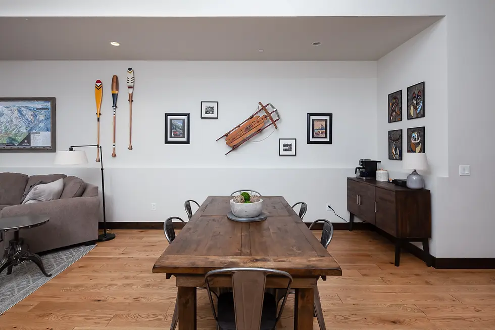
Guests staying at Glacier Adventure Loft in downtown Whitefish can reach the Glacier National Park entrance in about 30 minutes and the Whitefish Mountain Resort base in a short drive, with the SNOW bus stop just steps from the front door for ski days. The condo's location at town elevation, with shared river access directly across the street for kayak and SUP launches, reflects what the 2,999-foot valley setting actually offers: waterfront recreation, walkable downtown amenities, and easy access to higher terrain above.
Why Do Elevation Figures for Whitefish Vary Across Sources?
Elevation discrepancies for Whitefish, MT across different websites occur because different sources measure different things or use different methodologies. Specifically, the authoritative figure of 2,999 feet comes from the U.S. Geological Survey Geographic Names Information System, which uses a single benchmark elevation for a named place. Tourism and travel sites sometimes round this to "approximately 3,000 feet" or "just over 3,000 feet," which is accurate as a casual reference but technically incorrect by one foot.
The more significant source of confusion is when resort elevation figures get attributed to the town. If you read a travel article stating "Whitefish sits at over 6,000 feet," the author likely encountered the resort summit figure and applied it to the city. That is a 3,800-foot error. The USGS GNIS figure of 2,999 feet is the authoritative government-recorded elevation for the city, not the mountain.
Resort-reported elevations can also vary slightly depending on measurement point and year of survey. Whitefish Mountain Resort officially reports its summit at 6,817 feet on the ski area stats page. Some older documents cited 6,816 feet or 6,818 feet due to survey methodology differences. For planning purposes, treat 6,817 feet as the current standard figure for the summit.
A third source of confusion: the resort was known as Big Mountain until a rebranding in 2009 to Whitefish Mountain Resort. Older guidebooks and ski references may use Big Mountain's elevation measurements taken under the previous name, which refer to the same physical summit at the same elevation. The name changed; the mountain did not.
Is Whitefish a Better Base Than Kalispell for Mountain Access?
Whitefish is the stronger base for mountain access compared to Kalispell for most visitors, specifically because of proximity to both Whitefish Mountain Resort and Glacier National Park. Whitefish sits approximately 15 miles north of Kalispell. That difference in position means Whitefish is meaningfully closer to the resort's base at 4,464 feet and the park entrance at West Glacier. For ski trips, the SNOW bus runs directly from downtown Whitefish to the resort base, making a car optional on ski days. Kalispell lacks that direct transit connection.
Kalispell is the commercial hub of Flathead County, with a larger selection of big-box retail, the regional airport (Glacier Park International Airport), and a broader hotel inventory. If your primary goal is logistics, airport access, or cost-sensitive accommodation, Kalispell makes sense. If your primary goal is getting to the mountain or the national park quickly and spending evenings in a walkable town environment, Whitefish wins clearly.
The elevation difference between the two towns is modest. Kalispell sits at approximately 2,956 feet, very close to Whitefish's 2,999 feet. Both are in the same Flathead Valley floor. The elevation advantage is not a factor in choosing between them. The practical advantages are distance, transit access, and the character of each downtown.
Whitefish's downtown, centered around Central Avenue, has a genuine restaurant and bar scene that Kalispell's more commercial layout does not replicate. For skiers and outdoor enthusiasts spending evenings in town after a day at elevation, that walkability matters. For our full local dining recommendations, see our guide to the best restaurants in Whitefish MT.
Best Trails in Glacier National Park: What the Elevation Means for Hikers
Glacier National Park's trail elevations span from roughly 3,000 feet at valley floors to over 8,000 feet at high alpine ridges, making the elevation of Whitefish MT at 2,999 feet a genuinely ideal staging point. Visitors traveling from Whitefish to the park gain elevation as they drive, arriving at the lower trailheads near West Glacier at around 3,200 feet and climbing toward Logan Pass at 6,646 feet via Going-to-the-Sun Road.
For hikers, the practical implication is this: if you can comfortably hike at Whitefish Mountain Resort's summit at 6,817 feet without distress, you are well-prepared for Glacier National Park's most popular high-country trails. The Going-to-the-Sun Road's Highline Trail begins at Logan Pass at 6,646 feet and traverses ridgeline terrain. Spending a day at the resort summit before attempting Glacier's high trails is not a bad acclimatization strategy.
The Many Glacier area of the park sits at roughly 4,900 feet, making it more accessible for visitors who want sub-alpine scenery without committing to the 6,000-foot-plus terrain of Logan Pass. From Whitefish, Many Glacier requires driving east through Browning, adding about 90 minutes each way. Most day visitors from Whitefish target the Going-to-the-Sun corridor, which is more direct.
For detailed trail recommendations organized by difficulty and elevation, our guide to the best trails in Glacier National Park covers the specific hikes worth planning around, including honest notes on permit requirements and parking logistics that most guides omit.
Frequently Asked Questions About the Elevation of Whitefish MT
What is the exact elevation of Whitefish, Montana?
The city of Whitefish, Montana sits at an elevation of 2,999 feet (914 meters) above sea level, according to the U.S. Geological Survey Geographic Names Information System (GNIS feature ID 2412257). This is the official government-recorded elevation for the city itself. Some travel sites round this figure to approximately 3,000 feet, which is technically close but one foot higher than the USGS benchmark.
What is the summit elevation of Whitefish Mountain Resort?
Whitefish Mountain Resort, known historically as Big Mountain, has a summit elevation of 6,817 feet and a base elevation of 4,464 feet. The total vertical drop is 2,353 feet. The summit is approximately 3,818 feet higher than the city of Whitefish, which sits in the Flathead Valley below. These are the resort's officially reported figures per the skiwhitefish.com mountain stats page.
Is Whitefish, Montana considered high altitude?
At the town level, Whitefish is not considered high altitude. The city's 2,999-foot elevation is well below the approximately 8,000-foot threshold where altitude sickness typically becomes a concern for healthy adults. The resort summit at 6,817 feet is in a moderate range where some visitors, particularly those traveling from sea-level cities, may notice mild fatigue or headaches with heavy exertion on the first day. Staying well-hydrated before and during ski days is the standard practical precaution.
How does the elevation of Whitefish Mountain Resort compare to Logan Pass in Glacier National Park?
Whitefish Mountain Resort's summit at 6,817 feet is actually slightly higher than Logan Pass in Glacier National Park, which reaches 6,646 feet on Going-to-the-Sun Road. The difference is 171 feet. Many visitors assume Logan Pass is the regional high point, but Big Mountain's summit edges it out. Both elevations are in a similar sub-alpine range, though Glacier National Park's interior peaks extend far higher, with several summits exceeding 9,000 feet.
Why do some sources list a different elevation for Whitefish, MT?
Discrepancies arise because different sources measure different reference points. The USGS GNIS figure of 2,999 feet represents a single benchmark elevation for the named city. Tourism sites sometimes round to 3,000 feet or, more problematically, confuse the resort summit elevation (6,817 feet) with the town's elevation. The USGS Geographic Names Information System is the authoritative source. Resort-specific variations (6,816 vs. 6,817 vs. 6,818) typically reflect minor differences in survey methodology across different years of measurement.
Is it better to stay in Whitefish or Kalispell for skiing at Whitefish Mountain Resort?
Whitefish is the better base for skiing at Whitefish Mountain Resort. Both towns are in the Flathead Valley at similar elevations (Kalispell sits near 2,956 feet; Whitefish at 2,999 feet), so elevation is not the differentiating factor. Whitefish offers the SNOW bus, which runs directly from downtown to the resort base, the walkable Central Avenue restaurant and bar scene for après-ski, and significantly closer proximity to the resort compared to Kalispell's more commercial, driving-oriented layout.
What does the elevation mean for visiting Glacier National Park from Whitefish?
Whitefish's 2,999-foot town elevation makes it an ideal valley base for day trips into Glacier National Park, which spans elevations from roughly 3,000 feet at its valley floors to over 8,000 feet at high ridgelines. The drive from Whitefish to the West Glacier park entrance takes approximately 30 minutes. Logan Pass on Going-to-the-Sun Road at 6,646 feet typically opens to vehicles in mid-June, weather permitting, and requires a timed-entry reservation in peak summer months through the National Park Service ticketing system.
Can I book a vacation rental in downtown Whitefish walking distance to skiing?
Yes. Downtown Whitefish has vacation rental options within walking distance of the SNOW bus stop, which runs directly to Whitefish Mountain Resort's base at 4,464 feet. The Glacier Adventure Loft, a 2-bedroom, 1-bath condo managed by The Peak Properties, is steps from the SNOW bus stop and offers a covered parking space for days when you drive to the resort or to Glacier National Park. See availability at the Glacier Adventure Loft booking page.
Planning Your Whitefish Trip Around Elevation
The elevation of Whitefish MT is a two-part answer that shapes two different trip experiences. At 2,999 feet, the town is a comfortable, low-altitude base with Flathead Valley weather, direct lake access, and a walkable downtown that functions as well in July as it does in January. At 6,817 feet, Whitefish Mountain Resort delivers one of the largest ski areas in the western United States by vertical drop, with nearly 300 inches of annual snowfall on south-facing terrain that holds powder well.
The gap between those two numbers is the destination. You land at valley elevation, step out into a compact mountain town, and within 30 to 45 minutes you are standing on a summit higher than Logan Pass in Glacier National Park. That vertical range is what makes Whitefish function as a four-season destination rather than just a winter resort town.
For travelers comparing mountain destinations in the region, our Teton Valley properties in Driggs, Idaho offer a comparable base-to-summit elevation dynamic with Grand Targhee Resort, and The Peak Properties manages mountain rentals across Colorado, Montana, Idaho, and Pennsylvania for travelers who want to compare options across multiple ranges.
Whitefish rewards travelers who understand its elevation structure. Book the resort, plan for the park, and use the town's 3,000-foot valley floor the way it was designed to be used: as a genuinely comfortable base that does not require acclimatization, located within striking distance of some of the most dramatic sub-alpine terrain in the northern Rockies.

Glacier Adventure Loft is the base we recommend for visitors who want to experience both of those elevation zones. The 2-bedroom, 1-bath condo sits at the 2,999-foot town level, steps from the SNOW bus to the 4,464-foot resort base, and 30 minutes from Glacier National Park's valley entrances. The 20-foot ceilings, Sonos sound system, and MoccaMaster coffee setup are there for the mornings before and evenings after the elevation change. Check availability for Glacier Adventure Loft here.
Written by Michael Leonard, Owner & Manager at The Peak Properties


Comments